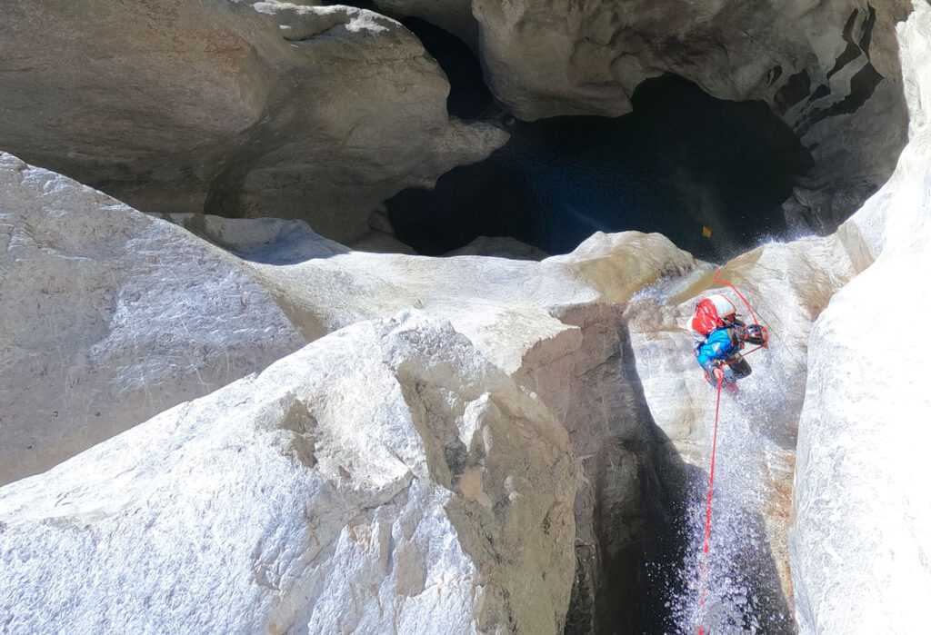
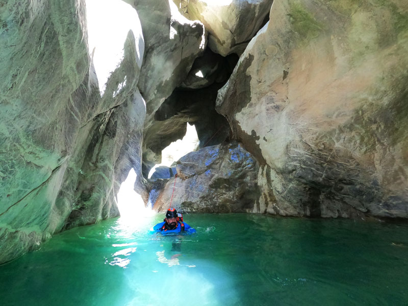
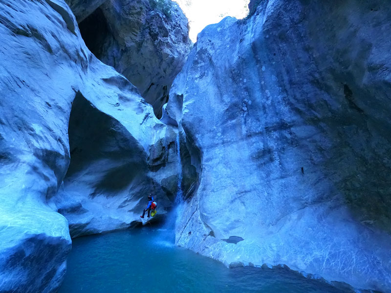
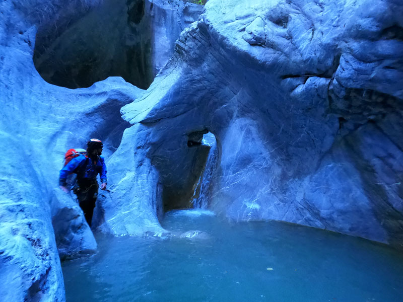
A spectacular canyon among those in the Permët area that will lead us through spectacular geological formations and some cavities, making this one of the most aesthetic and pleasant descents in the area.
It offers us the possibility of making several jumps and slides with clean water, but which will become murky as we pass through the canyon.

ÇARÇOVËS CANYON GPS TRACK
ÇARÇOVËS CANYON’S TOPO
You will find topographies in the three books described in the Çarçovës canyon sheet below.
ÇARÇOVËS CANYON’S DATA SHEET
Activity: Canyoning in Albania
Other toponyms: Leskovik Canyon
Starting point: SH75, km 9 aprox
Nearest town: Çarçove
Car combination: Not very useful*
Approach time: 10 ‘
Descent time: 2h 30′
Return time: 35 ‘
Difficulty: v4a3IV
Longest abseil: 35 mts.
Rope: 2×40
Cartography:
Soviet Military ~ 1980 – 1: 50,000 (Via Russian Topomaps APP)
Bibliography:
Canyonisme en Albanie – Guillaume Coquin
Wild Albania – 1º International Canyoning Meeting – Vertical Water
Albania Canyoning – Pascal Van Duin
Observations: Provide replacement material to install, just in case.
*In 2023, the walkway that allowed you to descent the canyon with only one vehicle was in very poor condition, potentially impassable and forcing you to leave a second car at the exit.


Access and approach to Çarçovës canyon in Albania
From the village of Përmet we will go to Çarçovë on the road that leads to Korça and also to Greece.
When we get to Çarçove, we will take the right turn in the direction of Leskovik. The main road is in the process of being paved, and it is expected to be completed shortly. The track that leads to Leskovik, on the other hand, in 2021 was still paved with the characteristic Albanian asphalt, with some potholes on the road, but which allows us to drive calmly with our van.
We will drive around 9 kilometers along the paved track, as the guide says, and we will leave the car at the foot of a large electricity tower.
For more references, from the electric tower where we have to park we will also see a large bauma to the right of the road, a little further on, and in the background, beyond the road, another light tower, point where we will look later the way down to the ravine.
If we also look at it, from the parking lot we can see the start of the 35 (now also 30) rappel and the large embedded blocks that form the small dark areas of the ravine.
NOTE: New hydroelectric constructions practically take all the flow in the ravine, it is highly recommended to approach the catchment upstream (we can go down there on foot from the road) and search near the catchment, or inside the house of the turbine that is above it, the nice guard who lives there to ask him if there is any planned maneuver that could compromise our safety. The guy we met there is very friendly, but he doesn’t speak English, so with Google Translate we were able to understand each other, especially in the question: A nuk do të hapin portat e võrshimit?
From the car park we will follow the road passing under the big bauma and heading towards Leskovik, we will reach the second big electric tower that we can see from the car. Here we will see how some goat paths go down into the ravine. If we take them to the right, without too much haste to go down to the river, we will end up arriving at the bed of the Çarçovës ravine or Leskovik river by a path that can be a bit difficult to follow as it sometimes gets lost in the bushes. A little guidance and common sense will help us.
ÇARÇOVËS CANYON DESCENT
We start the ravine at the confluence of the Leskovik river, which carries the waters of the Çarçovës ravine, and another stream that also carries a little water.
In front of us, a white limestone gorge that gradually narrows over which we can see a small wooden bridge in very poor condition. Which we reach by overcoming a first ridge without difficulty, and a second one, also easy, but a little higher.
We will walk under this bridge and the ravine of Çarçovë will turn slightly to the right. We will find the first installation on the left, with a bolt with a ring thanks to which we will be able to descend these few five meters.
We will walk along the ravine for a few tens of meters, first we will make a small turn to the left, and at the next one, when the ravine faces to the right, and the sun penetrates it a little, we will look for the next installation on the left , which with about 15 meters will allow us to descend the next vertical.
From above, it may seem that we have to reach the water with the rope, but about two meters above it, and below us, there is a small cavity where we will reach well. Equally, however, the recovery of the rope is much more comfortable once in the water of the pool that we see from the top of the rappel. With the little sun that enters the ravine, the waters take on a wonderful turquoise hue.
The ravine continues, and not without swimming a little, it shows how aquatic this ravine is, we will reach the next abseil, again to the left, and of about six meters, which would seem feasible to jump. We will swim out of the water, and immediately we will come across the great vertical of the Çarçovës ravine, the 35-meter abseil, equipped on the left wall very high up (so much so that it is almost difficult to find) and outside the active.
Since we bring material to install, we decide to install a new head in the center of the ravine, in a large block very obvious and access to which is not compromising, resulting in a new rappel of about 30 meters down the active
From this point on, things change a lot, the ravine becomes very congested, and takes on a very, very aquatic atmosphere. And for dessert, we won’t see the sun until sunrise. This fact will make us print a very high rate of progression, which together with the cold caused by the continuous contact with the water will wear us out physically and mentally even if we make the descent with a dry suit.
Coming out of the large pool of water at the base of the 30-meter rappel, a three-meter jump puts us right below the huge boulders embedded in the air that obscure the ravine, followed by a beautiful rappel of about ten meters , equipped on the right. Despite how cold we are, it is impossible not to look up and be amazed by the incredible environment in which we find ourselves.
We continue along the ravine, speeding up our pace of progression and we pass a new waterfall of about 10 meters according to the topo of the Canyonisme en Albnie guide, but which is perhaps a little lower. Either way, we’ll find it equipped on the right.
We will quickly get out of the water and continue progressing without wasting too much time to find a new installation on the right to overcome the 10 meters that continue to enter this wound in the rock, and that again, leave us in a puddle of water that you have to swim out of.
Some rugged ridge, and of course, also some small section of swimming, separate us from the last abseil we find equipped in this beautiful and cold ravine.
A ramp on the left where the water goes down has an unusable bolt, and in a dry pot on the right we will find a facility to overcome this obstacle safely.
Another time we will end up swimming out of the water, to leave the place through a long corridor with sloping walls to the left. We will walk a little until we reach a very scenic point, where there are numerous cavities, some of them connected to each other, on the left wall of the ravine.
Here there will be climbs and sections of swimming, even a hole in the rock through which the water flows, and which in case of high flow can be dangerous, since it will be sucking and on the other side the fall all and that it does not exceed two meters is important. In the current conditions it is not a problem for us to climb to the right.
We will follow a generous section in terms of climbs, small jumps and slides, and some pools of water that can be a bit difficult to get out of, until a long corridor, where we will swim and with a little trace we can search for the shallow part in the left to walk out.
At the end of this, the unusable and damaged dam due to some flood, the exit from the ravine and the sun, whose warmth suits us so much. Above the corridor, the wooden and gravel bridge that will serve us to take the return path.
HOW TO RETURN FROM ÇARÇOVËS CANYON
NOTE THAT THIS DESCRIPTION IS INTENDED FOR CROSSING THE CANYON VIA THE WOODEN WALKWAY AND THIS MAY BE IN VERY BAD CONDITION, you will find how to descent the canyon using two vehicles in the guides described in the canyon sheet.
After the cold we’ve been through, we’ll leave on the right side of the dam, and we have two options to find the way back. The safest way is to go up the track that, to the right of the dam, goes up the right bank of the Leskovik river in a downstream direction. Immediately we will find a turn to the right, which continues to ascend. After about ten meters, we will stay attentive to the right of the track, as there is a path that will take us to a scree, which we will descend to find the path that goes to the bridge that crosses the Çarçovës ravine.
Otherwise, and faster, although also exposed to a good ass blow, to the right of the dam, and immediately where we would take the track that we mentioned in the first option, we will see a landslide with very little or no obvious trace which leads to a clearing between the trees at the top of the landslide. This clearing between the trees is the beginning of the path that leads to the bridge, the point where it connects with the path of the first option.
So on the track, you will find this second option recorded, the one that goes up the right, more direct landslide. When we reach the bridge, we will cross it and always follow the most obvious path that leads us back to the road.
It is worth saying that in general the path is very well-trodden, although for some reason we do not know, at some specific points someone has thrown everything in the middle of the path, tempting us to believe that this is not the path, and to search – the continuity of the path between the scrub and the bushes.
In each and every one of these places, the most recommended thing is to walk carefully over the branch and look for the continuation of the path on the other side, in all cases it has been the best option.
The path then goes back up without too many breaks towards the road, which we will take to the left to return to the car.