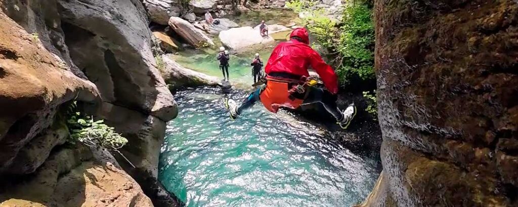
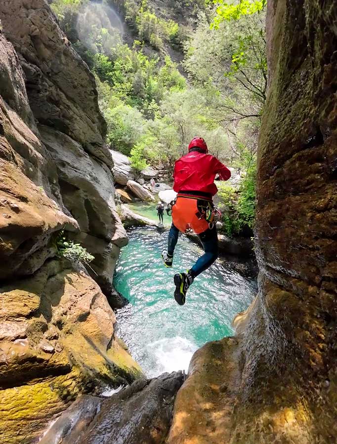
In front of us, what is possibly the descent with the most abseils in Albania, and if nothing else, the one with the most in the region.
A descent, that of the Dobrushes which, without being one of the longest in the country, offers us a huge diversity of obstacles in a very continuous and enjoyable way, because there will be successive waterfalls that must be rappelled, slides, and jumps, with verticals that go from more discreet of the rappels to a beautiful descent of up to 55 meters high. Heights apart, all together, served in an environment of great beauty as it cannot be otherwise, in addition to being able to enjoy fresh and clean water like few will see in the area.
The adventure begins, right from the start, with the approach, so friends, prepare well for the activity so don’t miss any detail, it’s worth it!

DOBRUSHËS CANYON CANYON GPS TRACK
DOBRUSHËS CANYON CANYON’S TOPO
You will find topographies in the books described in the canyon data sheet below.
DOBRUSHËS CANYON CANYON DATA
Activity: Canyoning in Albania
Other toponyms: Not known
Starting point: Google Maps link
Nearest town: Bogovë
Car combination: no
Approach time: 1h to 1h 30′
Descent time: 3h 30′
Return time: 10′
Difficulty: v4a3III
Longest abseil: 55 mts.
Rope: 2×60
Cartography:
Soviet Military ~ 1980 – 1: 50,000 (Via Russian Topomaps APP)
Bibliography:
Albania Canyoning – Pascal Van Duin
Observations: Provide replacement material to install, just in case.


ACCESS AND APPROACH TO DOBRUSHËS CANYON IN ALBANIA
We will drive from Berat towards Bogovë where, before crossing the river, we will take the left turn along the paved road to a water bottling plant of the Bogova Roi brand.
Right in front of this plant, a trail to the left leads up to the very obvious quarries that have completely changed the face of the mountain above us.
Approximately 1.2 kilometers up the track and in a tight curve to the left we will see a track that continues straight and downhill. We will follow this track for a little more than 500 meters until we reach some very obvious spaces that allow parking on the right and left.
We will follow the track where we arrived observing how it immediately becomes a path and descends to an iron bridge over the canyon, we will cross it and follow the path, quite good but in sections it blurs over slabs of rock and we will gain the ridge to continue – it up to a small collar at the height of a pole of the power line.
Here the most direct would be to follow the power line towards a small stream and continue as close as possible to the line until you reach the access.
In our case, we have deviated to the right of the pass, following a very obvious and shady path that goes back to the village of Dobrushë where, just as we reach the first houses, we will take the track or path to the left that between the fields takes direction towards the quarries on a good path, passing under what looks like a cemetery. The path below the cemetery in the future is flat and wide, we will pass to the right of some buildings in ruins and next to the canyon we will go down under the power line reaching a stony space where we will turn to the right to reach the beginning of the canyon.
DOBRUSHËS CANYONING DESCENT
We begin the descent in an open space, but that will immediately change, ceding the limelight to the rock, which, although it will not deprive us of stunning views, will form shy corridors with the first puddles where we can refresh ourselves after the long approach.
A small slide and a nice jump from the left will be followed by a more open environment again, also starring the stone, with some jump and a small passage that leads us to the first abseil, installed on the left , where we could also avoid it, but what would be the point of avoiding this beautiful rappel of about 30 meters?
We continue the descent enjoying an enormous diversity of spaces and environments until we come across the next abseil of about 15 meters installed on the right.
We will continue, now through a medium-sized gorge to look for a new rappel that forms a kind of essa and that is followed by what looks like a slide, but which we value not to do, since it has a boulder on the right and under the water where we could get hurt.
We will continue through beautiful corridors until we reach a very obvious jump that we can do if we take a rock ledge to the right, but be careful not to jump forward, as we can touch the wall.
We go out through the corridor, securing with rope a de-climbing in the form of a ramp. The jumps follow one another and we will do a very winding abseil installed on the left and of which we will not see the end, which we will leave half way to finish it by de-climbing and not risk having problems with the recovery of ropes.
We will continue along a rappel that is around thirty meters and that leaves us just before the rock arch, where on the right we will look for the beginning of a handrail to access the next head, which is very exposed. Despite the fact that the vertical is higher than 20 meters, with a rope of 30 double it is enough for us to reach a landing and finish dismounting and continue our descent.
The canyon momentarily opens up to give way to a new and long abseil, according to the review, about 34 meters long, which starts on a ramp and ends up gaining verticality in its final section, falling to a wide, very shallow ledge.
We will walk until we find a new obstacle, a clear jump of about 6 or 7 meters, more if we look for a rocky point on the right.
We continue the descent, with jumps, jumps and some slides until we suddenly come across a wonderful balcony open to the main course of the valley. At our feet, a vertical that is around 60 meters high, divided into a first abseil from the left and of about fifteen meters according to the review, to search, again to the left and outside the water at the beginning , the last part of the rappel, about 42 meters of spectacular descent, all in all, very aesthetic.
Almost immediately we find a seven meter rappel to the right and some bumps lead us to the confluence with the right tributary, dry.
The section that follows is very playful, slides and jumps along a more or less narrow corridor depending on the point, always dressed in intense green. We will guess the next abseil because, equipped on the left, it goes over an inclined ramp to end up in a puddle where you can guess, obviously, the gravel that prevents you from making a slide.
We will continue and find some more bumps and jumps, not too many, until we guess, very obviously, the path and the cave of the spring, where we can go a little more than a hundred meters.
About three hundred meters downstream, we will guess the iron footbridge we crossed earlier. Now, however, we will cross it below and climb onto the rocky ledge on the right to jump, being careful not to slip and get hit on the ass or ribs, into the generous pool artificially formed by a water catchment, which unfortunately wipe the canyon for a few moments.
We will go to the very small dam that dries up the torrent to make a new rappel of about 50 meters, at the base of which we will look for the last rappel, which is wrongly topographiced with a height of 14 meters, and is well around twenty.
We only have to make an obvious jump of about 6 or 7 meters to complete our good descent and reach the confluence with the Bogovë canyon.
HOW TO RETURN FROM DOBRUSHËS CANYON
After finishing the canyon, at the confluence of the Dobrushës and the Bogovë, we will take the track for a few meters to find a trail that goes back to the water catchment huts.
We will go around these houses on the left (uphill), be careful if the dog is there, as it is aggressive.
Above the catchment houses we will find a path that takes us to the iron bridge where, turning left, we will follow the path to the car.